ArcGIS Storymap on the Lower Spring Branch Creek Enhancement Project
My name is Catie Thow, I am a second-year master’s student at San Francisco State University’s Estuary and Ocean Science Center studying phytoplankton primary productivity and nutrient uptake in Suisun Marsh. Throughout California’s shelter-in-place mandates I worked on an interactive ESRI StoryMap with the San Francisco Bay NERR. The goal of this project was to create an informative and interactive webpage that showcased the Lower Spring Branch Creek Enhancement Project that was completed in Fall, 2019.
Throughout my professional career I have learned to use ArcGIS software to create engaging and interesting maps. During my graduate experience I have created two different webpages with varying styles and purpose, so, when the NERR asked me to create an ERSI StoryMap, which seeks to include engaging maps with standard webpage characteristics, I was excited. The thought of combining my experience in map making and webpage development to create a site where visitors could learn about restoration in the San Francisco Estuary sounded like a great opportunity for me to dive in deep and explore science communication in a different context.
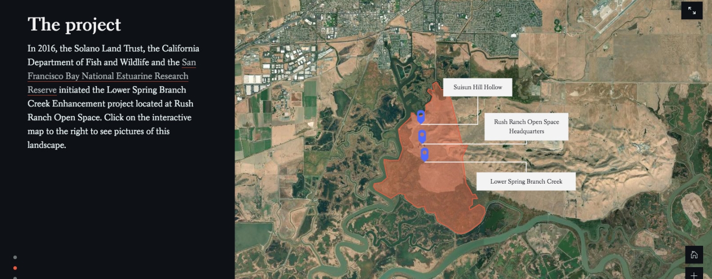
The goal of an ESRI StoryMap is to use maps, photos, and videos to convey an important message, in this case the successful restoration of Lower Spring Branch Creek. So where did I start? With a short visit to Lower Spring Branch Creek located at Rush Ranch Open Space Preserve in Suisun City, CA to gain some on the ground inspiration. Excitedly, as I toured the recently restored site I saw evidence of river otters, wading water birds and of course, the new 20 foot arched aluminum culvert which now allows water to pass more freely. Back at the computer, I sorted through hundreds of pictures, videos and restoration design and planning documents with the goal of finding the most engaging. Knowing little about construction, I contacted Dr. Stuart Siegel, Project Team Lead and SF Bay NERR Coastal Resilience Specialist to help me identify important points in the construction.
A few months later, I, together with the San Francisco Bay NERR are enthusiastically announcing that the StoryMap is finished and ready to be viewed. ESRI’s StoryMap platform is certainly a great tool that allowed me to showcase this successful restoration project and I encourage everyone to check out to make a story of your own. Stay tuned for one featuring my graduate work!
Feel free to check it out and contact us with any questions.
Related News