System Wide Monitoring Program
Long-term monitoring is essential to understanding ecosystems and placing shorter-term research into context. In an estuary, water-quality and weather data are especially important. The National Estuarine Research Reserve System conducts high-quality, standardized monitoring at each of the National Reserves.
Learn more about the data we collect and how to access it below.

Water Quality Monitoring
Water Quality Stations
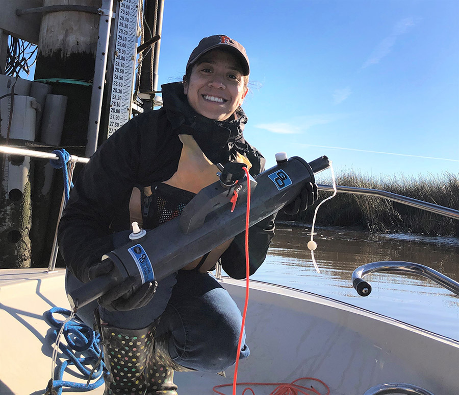
We maintain four water quality stations in our reserve sites, two in China Camp State Park and two in Rush Ranch. Data from these stations is available in near-real-time, in addition to the near-real-time monitoring data, supplementary samples are taken at each site once a month. See the sidebar for details on the parameters collected.
Gallinas Creek
San Rafael, Station Code: SFBGCWQ
China Camp
San Rafael, on the historic pier at the Village, Station Code: SFBCCWQ
First Mallard
Rush Ranch, Suisun Marsh, Station Code: SFBFMWQ
Second Mallard
Rush Ranch, Suisun Marsh, Station Code: SFBSMWQ
Richardson Bay
In addition to these water quality stations, we maintain both a water quality and meteorological station in Richardson Bay in partnership with the Smithsonian’s MarineGEO & Tennenbaum Marine Observatories Network. These data are not currently available online; contact the Research Director for more information.
Near-Real-Time Water Quality Parameters
At our four core stations the following water quality parameters are measured every 15 minutes:
- water level
- temperature
- salinity
- dissolved oxygen
- pH,
- turbidity
At Richardson Bay the following water quality parameters are measured every 15 minutes:
- water depth
- temperature
- salinity
- dissolved oxygen
- pH
- turbidity
- fDOM
- BGA-PE
- chlorophyll
Monthly Water Quality Parameters
The following water quality parameters are measured monthly at each station:
- ammonium nitrate
- nitrite
- ortho-phosphate
- chlorophyll a
Meteorological Monitoring
Meteorological Stations
We maintain one meteorological station at our reserve site at Rush Ranch. Data from this station is available in near-real-time. See the sidebar for details on the parameters collected.
Rush Ranch
The Rush Ranch meteorological station is located on the edge of the marsh, near Suisun City. Station code: SFBRRMET
Richardson Bay
In addition to these water quality and meteorological SWMP stations, the San Francisco Bay NERR maintains both a water quality and meteorological station in Richardson Bay, located at 37° 52′ 36.09″ N, 122° 29′ 15.23″ W, in partnership with the Smithsonian’s MarineGEO & Tennenbaum Marine Observatories Network. This station has been in operation since April 2016. These data are not currently available online; contact the Research Director for more information.
Parameters
The following meteorological parameters are measured every 15 minutes at both stations:
- air temperature
- barometric pressure
- wind speed
- wind direction
- total PAR
- precipitation
- relative humidity
Vegetation Long-Term Monitoring
San Francisco Bay NERR also conducts long-term monitoring of emergent vegetation at China Camp and Rush Ranch. These data are not currently available online; contact the Research Director for more information.
Oyster Surveys
Monthly oyster recruitment on the Marin County shoreline, and annual bay-wide oyster population surveys. These data are not currently available online; contact the Research Director for more information.
